A volatile season of heat, storms, humidity, and flooding has seen Australia record one of its wettest El Niño summers on record.
Despite the increased rain, according to the Bureau of Meteorology's preliminary summer recap, Australia looks set to record its third warmest summer on record, behind 2018-19 and 2019-20, comparing all years back to 1910
Persistent and heavy rain on the east coast also landed Australia its third wettest summer for an El Niño year, behind 2009-10 and 1994-95, though Western Australia and Tasmania have been left wanting.
"We have had a bit of everything this summer — tropical cyclones, floods, fires, heatwaves and dry conditions on the west coast," Monash University climate scientist Kim Reid said.
The Bureau's official national summer wrap and maps will be released later today.
But a look at the available data shows several Australian capitals recorded some of their highest summer temperatures on record, made particularly uncomfortable in the east by warm nights and high humidity.
Live Moment
Look back at how ABC readers and other Australians responded to this live moment.
We've had such a great time this morning.
Thanks for all your engaging questions, and of course a big thank you to Monash University's Kim Reid and Michael Barnes for helping us answer them.
To conclude, here's a couple of final comments from them both about the summer of 2023/24
Michael: "This summer’s weather has been interesting and will be the source of much scientific inquiry over the coming years I suspect. A variety of weather systems have influenced Australia this summer in various ways, from Tropical Cyclones in the north-east, cut-off lows with rain in the south and a persistent heat trough over WA bringing extended heat. The scientific community will no doubt be studying this summer and the various influences in order to understand what has influenced the weather summer, by how much and how this fits into our weather and climate story in the coming century."
Kim: "Hopefully, everyone can see just how complex the weather can be and why it’s important to be prepared for all kinds of extremes during summer. If you thought this summer was hot, remember this summer will be average or even considered ‘cool’ compared to summers at the end of the century. That is why it is so important to stop burning fossil fuels as quickly as possible."

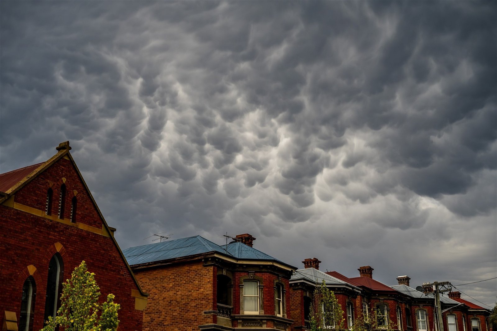
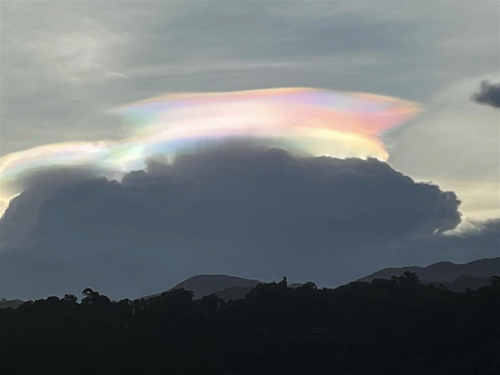
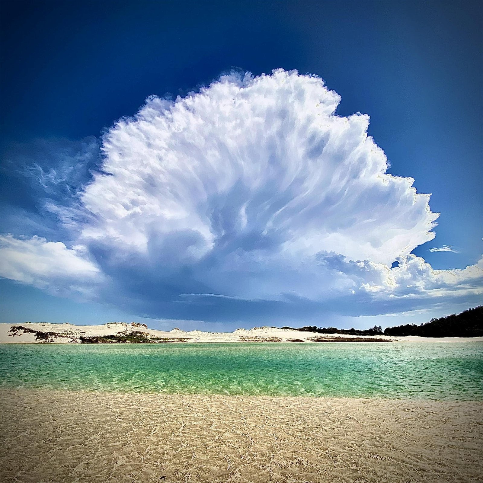
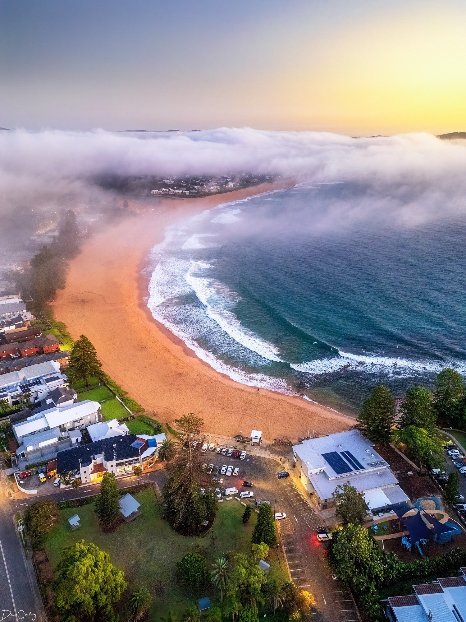
It's been a summer of extremes – and that makes for some great photo opportunities.
Here are a few of our favourites, from the Weather Obsessed Facebook page from the last month.
Do the BOM models for rainfall predictions in SE QLD have a greater margin of error when El nino and the indian ocean dipole are at work ?
- Mike
Hi Mike,
Kim Reid and Michael Barnes aren't with us anymore.
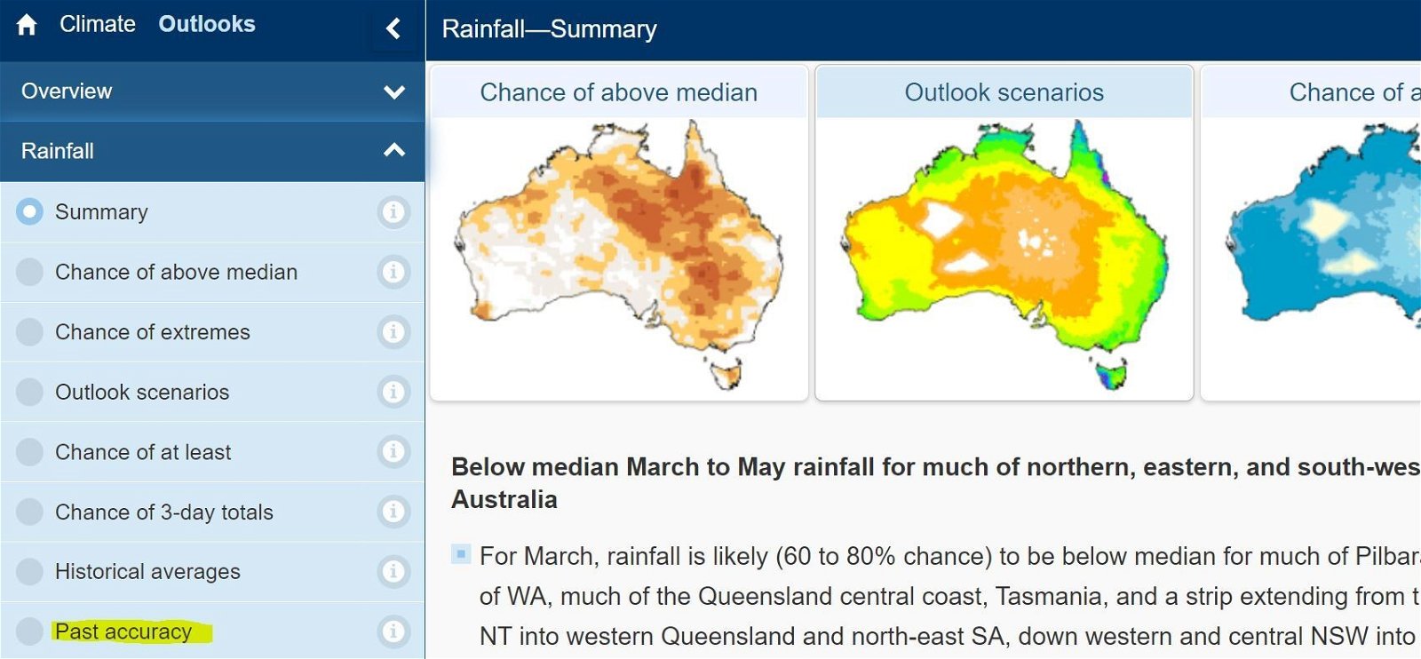
But the Bureau of Meteorology does show "past accuracy" of their long-range forecasts on their website (link below).
This gives you a sense of how well they've performed during a certain period in the past.
This photo shows what the website looks like. 'Past accuracy' is on the tab on the left.
Wondering what this is? Join us next time we're live and be part of the discussion.
Snapshot of the cities
Brisbane
Brisbane endured its second warmest summer on record overall, and conditions throughout the season described as "oppressive" by meteorologists due to high humidity and warm nights.
It was also considerably wet, with both days of rain and total rainfall figures well above normal.
The data shows the overnight minimum temperatures for the city were the highest on record, sitting 2 degrees above normal, while daytime highs were also much warmer than normal.
Across broader Queensland, the Bureau said summer had been warmer than usual for most of the state, and wetter for many areas, with cyclones helping to produce record breaking downpours across northern parts of the state.
Sydney
In New South Wales, Sydney sweated through its third hottest summer on record, with rainfall days and totals also well above average.
Daytime maximums at Observatory Hill – the city's main weather station — were particularly high, with the temperature 2.5 degrees above the long-term average.
Like much of the east coast, the city also faced unusually high humidity, which averaged 69 per cent at 3pm – 7 per cent above the norm.
Elsewhere, around NSW and the ACT, it was also warmer than normal, tracking to be the state's tenth-warmest on record, according to the Bureau.
It was also wetter than normal for much of the state.
Canberra
Warm nights in Canberra helped deliver its warmest summer in four years.
But the biggest story was the rain – with the city facing its wettest summer in 29 years.
The warm nights were partly the result of high humidity, which was 11 per cent higher than usual, based on the 3pm figures.
Melbourne
Victoria was the only state to not likely finish in the top 10 warmest years on record, according to the bureau, though it was still warmer than normal for most, away from the far west.
It was also very wet across the state, tracking 55 per cent above the average.
Despite Melbourne's summer being the sixth coolest so far this century, the city's temperatures were still above the long-term average.
Overnight temperatures were particularly warm, nearly 2 degrees above the long-term average.
Along with most of eastern Australia, a notable feature of Melbourne's summer was high humidity which averaged 8 per cent higher than normal at 3pm.
Hobart
Tasmania joined the party on the warmer-than-normal weather for the summer, recording its ninth warmest summer on record.
It was also one of the few states that had a drier than normal season — falling short of its average by 18 per cent overall.
Hobart's summer was the warmest in five years, with both minimums and maximums about 1.5 degrees above average, making it the city's sixth warmest summer on record.
Hobart was also unusually dry, with a summer total well below the average, which made it the driest summer in four years.
Adelaide
It was a cool and wet summer for Adelaide, with the city's mean temperature ranking as the fourth coolest so far this century.
But, on the whole, South Australia still finished the season with warmer than usual temperature for most of the state.
Nights were particularly chilly for the season, averaging 16 degrees at Adelaide's West Terrace station.
The season also saw an unusual amount of rainfall, with the city recording about double what it normally does in summer, making it the wettest summer in seven years.
Perth
WA has broken records this summer, sweltering though what the bureau expects will come in as the warmest summer on record.
In contrast to the rest of the country, the state also struggled to get a decent drop of rain, with parts of the Gascoyne "bone dry" dry up until last week, when Tropical Cyclone Lincoln turned the story around, according to bureau forecaster Jessica Lingard.
"People are just crying out for rain," she said.
The state's capital, Perth, sweltered through its third-warmest summer on record, including nine days above 40 degrees – well above the average of two days.
The city's maximums were especially high at 32.5 degrees, more than 3 degrees above the long-term average and the second highest since records began back in 1897, only behind 2021-2022.
Northern Territory
The NT technically doesn't have a 'summer' season, but instead is in the thick of its 'wet season'.
The wet season continues until April, but data from the bureau has shown the last three months have been largely warmer than normal for the state, currently on track for its fifth-warmest December to February on record.
This is particularly true for the south-west corner of the state, where it's on track to be the warmest on record, according to the bureau.
Rainfall has also been tracking well for the last three months, sitting above average for most of the northern half of the NT, but drier than usual in the south-west, according to the bureau.
What's the long-range forecast for autumn?
Autumn is less impacted by major climate drivers compared to other seasons, partly due to it being a transition period in the Pacific and Indian Ocean where episodes like El Niño will decay.
This results in a more unpredictable pattern of weather beyond a short-range weather forecast of up to around 10 days.
Nevertheless, the bureau's long-range outlook for autumn offers some clues.
It is currently projecting warmer nights and days to continue, with much of the country having at least an 80 per cent chance of above-average temperatures in the season ahead.
When it comes to rainfall the odds aren't quite as clear.
According to the outlook, there is a 60 to 75 per cent chance of a drier-than-normal autumn for most of New South Wales, Victoria, Queensland, parts of South Australia, northern and eastern Tasmania, south-west WA, and parts of northern WA.
For the rest of the country, however, it's roughly equal odds – which means it could go either way.
Use the slider below to see the temperature and rainfall outlook map from the Bureau for autumn 2024.
Before: The first map shows the Bureau is tipping warmer than average days for autumn nationwide.. . After: The second map shows the long-range outlook tips drier conditions for much of eastern Australia.. .
Instructions: Use left and right arrow keys to control image transition
As for fire, the Australasian Fire Authorities Council (AFAC)'s autumn bushfire outlook shows a typical fire risk for the majority of the season ahead.
There is an increased risk of fire in areas of Central Australia and southern WA.
https://news.google.com/rss/articles/CBMiWmh0dHBzOi8vd3d3LmFiYy5uZXQuYXUvbmV3cy8yMDI0LTAzLTAxL2F1c3RyYWxpYS1ob3Qtd2V0LWVsbmluby1zdW1tZXItMjAyMy0yMDI0LzEwMzQ5NDcxMtIBAA?oc=5
2024-03-01 02:26:15Z
CBMiWmh0dHBzOi8vd3d3LmFiYy5uZXQuYXUvbmV3cy8yMDI0LTAzLTAxL2F1c3RyYWxpYS1ob3Qtd2V0LWVsbmluby1zdW1tZXItMjAyMy0yMDI0LzEwMzQ5NDcxMtIBAA
Bagikan Berita Ini


0 Response to "End of summer snapshot shows one of the warmest, wettest El Niño summers on record - ABC News"
Post a Comment