The "danger day" is looming for Sydney and much of inland NSW as a serious weather system threatens to spill heavy rain over already saturated catchments, exacerbating the risk of flash floods.
But NSW is not the only state in the firing line; Victoria and Queensland are also at risk of flooding.
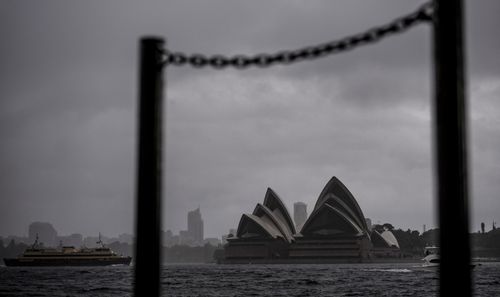
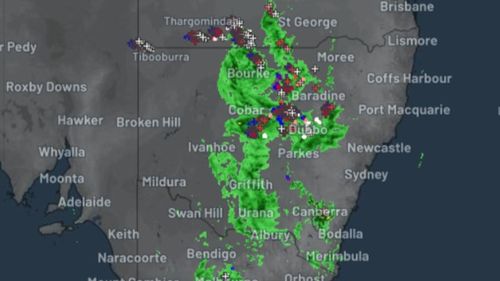
But the main risk is unfolding in NSW with Emergency Services Minister Steph Cooke previously warning Saturday would be the "danger day".
Meteorologist Dean Narramore said the wet weather is being driven by a trough that's tapping into tropical moisture.
"(That) will develop into a low-pressure system during the day, (bringing) widespread heavy rain and thunderstorms to much of western, northern and eastern NSW," he said.
"Going to move eastwards quickly today and expanding, then hit the coast later today into tonight.
"Severe weather warnings current for heavy rainfall and damaging winds from Newcastle all the way down to Ulladulla."
"Unfortunately the next weather system (arrives) Wednesday to Thursday with a burst of widespread heavy storms," he said.
Narramore's warning comes as residents near the Hawkesbury-Nepean Rivers face a possible fifth flood in 18 months.
The Bureau of Meteorology (BoM) said there's a minor, to moderate risk of flooding along those communities.
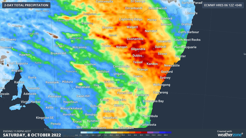
The worst of the rain is expected to hit later this afternoon.
"A trough line will move over the NSW Central Tablelands around 5pm," Weatherzone said in a statement.
"There will be some light and intermittent showers around on Sunday but no one will be pelted."
As of 7am, the SES have issued more than 60 flood warnings across the state, with nearly twenty of these deemed "watch and act".
The BoM has also issued a hazardous surf warning for pounding waves along the coast, and a severe weather warning is in effect.
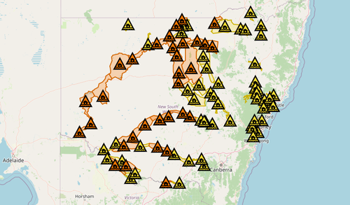
Weatherzone said this latest round or rain and storms is due to a cold front that's "tapped into abundant tropical moisture, which had already made its way south from northern Australia.".
"The situation will probably become extremely serious on the weekend, with heavy rain again forecast across a huge area, particularly on Saturday, and particularly north of the Murray River," the weather service added.
There's also a risk of minor to moderate flooding across a number of catchments across western and south-western Queensland as the system pushes east.
Areas around Baloo and the Paroo River are of particular concern.
Eastern Australia is currently in the grips of its third consecutive third La Nina , which is tipped to weaken early 2023.
Meanwhile, Victoria SES continues to clean-up after a fierce storm lashed the city.
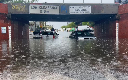
State Agency Commander Geb Abbott said Victoria has "seen the worst" of the rain but added flooding is still possible as water flows down catchments.
"Unfortunately, we're having to respond to vehicles that have been stuck in floodwater.
"A reminder for all areas that are experiencing flooding - please do not drive into floodwater, it may be one of the last things you do.
"We are still seeing water coming through the damp catchments. Flooding will be experienced in many areas. Crews are still out ready and prepared to respond and still engaging with the communities still likely to experience impact."
https://news.google.com/__i/rss/rd/articles/CBMiyAFodHRwczovL3d3dy45bmV3cy5jb20uYXUvbmF0aW9uYWwvd2VhdGhlci1mb3JlY2FzdC1hdXN0cmFsaWEtZGFuZ2VyLWRheS1sb29tcy1mb3Itc3lkbmV5LWFuZC1pbmxhbmQtbnN3LWFzLXJhaW4tYW5kLXN0b3Jtcy1leGFjZXJiYXRlLWZsb29kaW5nLWZlYXJzLWFjcm9zcy1xbGQtdmljL2UwZDNhN2FjLWU2MzYtNGM3NS05YzhkLTE5NDRlZTg0NDlmOdIBAA?oc=5
2022-10-07 21:11:36Z
1586610937
Bagikan Berita Ini


0 Response to "'Danger day' looms for Sydney and inland NSW as heavy rain and storms exacerbate flooding fears across multiple states - 9News"
Post a Comment