Residents across Victoria, NSW and Queensland have been preparing for floodwaters to rise as already saturated catchments are inundated by the deluge.
Flood-weary residents in Lismore, in the NSW Northern Rivers, are breathing a sigh of relief as the Wilson River peaks well below levels seen in the devastating February disaster.
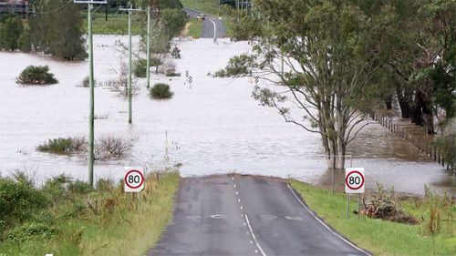
The river is currently sitting at six metres and is expected to peak at 7.8 metres around 8pm tonight.
In the February floods, the river peaked at more than 14 metres.
Locals are relieved that the floodwaters are well below the previous emergency as the community is only just recovering.
"Everyone was nervous. Everyone was really scared and upset, when you hear the rain and you see predictions that huge, 300mm would have smashed us," Lismore resident Paul Cregan said.
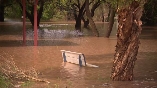
A moderate flood warning remains in place and is expected to impact parts of north and south Lismore.
Around NSW, 43 local government areas are declared natural disaster zones.
At Moree in the state's north, waters have spread across more than 100km of floodplains.
"We have a major flood emergency in full swing right across our state," Premier Dominic Perrottet said.
"We do expect rising floodwaters.
"In addition to that, we also expect flash flooding across New South Wales with further storms on the way."
Perrottet pledged support would be in place to aid communities wrecked by flooding.
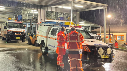
NSW State Emergency Service and Australian Defence Force crews were doorknocking until 1am this morning to warn residents to leave and said they are pleased with how locals have responded to warnings.
"It is a show of the town of Lismore and the people's resilience to what is in front of them," NSW SES Simon Merrick said.
"They have taken the warnings well and it is pleasing to see that people are not driving into floodwater."
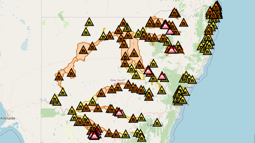
Meanwhile, floodwaters have swallowed Moree, in the state's north, while residents in Byron Bay remain under a "Watch and Act" weather alert after the CBD was hit with flash flooding.
"Around 4000 people have been told to evacuate at some point over the past few days," Emergency Services Minister Steph Cooke said.
"Unfortunately hundreds of properties have been impacted by these floodwaters."
Emergency Services Minister Steph Cooke said there's "literally a flood risk in every corner of the state."
"What we are currently experiencing is more flood threats in more communities and locations than at any other time this year," she said.
Victoria floodwaters expected to peak today
Residents in Echuca in northern Victoria are also bracing for rain as they prepare for their biggest test of the flood crisis.
It's hoped the mammoth effort to protect the town will be enough to hold up against the rising flood waters, with more than a quarter of a million sand bags used as a defence.
Residents on one side of the Murray River have escaped floodwaters, however the other side is experiencing a slow burn as the peak floods homes.
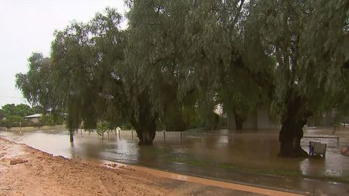
The situation is being made worse as stormwater is pumped out of the levee and is flowing into areas where homes are already flooded.
Residents have been left frustrated by the floodwaters and many are staying put to try and protect their homes.
"Where do we go when we're trying to keep the water out? Who is going to map the pumps if we leave?" resident Erin McCann said.
"I have had to send my kids up to their dad because I have to have somewhere for them to come home to."
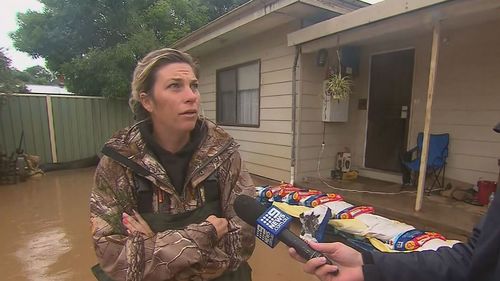
The flood emergency is continuing after 30mm of rain fell over the last 24 hours in Echuca and Kerang.
The Bureau of Meteorology's Kevin Parkyn said rain and thunderstorms were forecast to hit the state today, but the severe weather warning for heavy rainfall had been lifted.
Parkyn said the rainfall experienced in Victoria this month had created the 10th wettest October on record for the state.
He said that if the rain forecast for the coming Sunday and Monday did occur, Victoria was likely to see the wettest October ever recorded.
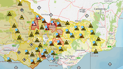
More than a dozen flood warnings for Queensland
The bureau has a hazardous surf warning in place from Ballina all the way into the south east Queensland corner.
On the Gold Coast yesterday, beaches were closed as waves around two to three metres pounded the coast.
There are more than a dozen flood warnings in effect across Queensland with a major warning current for the Macintyre River, which has inundated the town of Goondiwindi.
A major peak up to 10.2 metres is expected early Monday afternoon.
Queensland authorities said there had been 167 requests for help, including a water rescue, so far this weekend.
Volatile weather system bears down on Australia's east coast
The "intense" system will travel southwards over the course of the week before finally reaching Tasmania on Friday, Weatherzone said.
"Rainfall totals around the northern parts of New South Wales over the next few days could reach between 140-200mm," Weatherzone said, explaining what the next few days will hold.
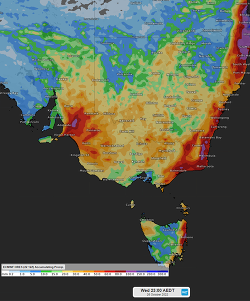
"As the system reaches the southeast coast of NSW rainfalls will continue to be significant with a possibility of accumulated falls of 40mm to 160 mm over a 3-day period, with the heaviest falls likely to be along the coast.
"Victoria will not escape the heavy falls with potential rainfall totals between 50mm and 150 mm later in the week.
"Continuing down to Tasmania we will also see some significant rain where totals may reach between 40mm and 150 mm."
The weather service said a high pressure system will form over NSW "bringing some respite" over the weekend, however that will be short-lived.
Another low pressure system will move across southeast Australia early next week.
https://news.google.com/__i/rss/rd/articles/CBMiqQFodHRwczovL3d3dy45bmV3cy5jb20uYXUvbmF0aW9uYWwvd2VhdGhlci11cGRhdGUtYXVzdHJhbGlhLW1pbGxpb25zLXVuZGVyLXRocmVhdC1mcm9tLXZvbGF0aWxlLWxvdy1wcmVzc3VyZS1zeXN0ZW0tc3dlZXBzLWVhc3QtY29hc3QvY2ZhY2Q5NGEtYjUyZC00MTY0LTlmMGItYzI3NWI2Yzg5NTJj0gEA?oc=5
2022-10-24 05:13:37Z
1620371691
Bagikan Berita Ini


0 Response to "'Hundreds of properties' swallowed by floods as thousands evacuated - 9News"
Post a Comment